RangeSight™
Calculate your drone's real flight range, not factory specs. Powered by the RangeIQ™ on-device physics engine that accounts for wind, weather, payload, battery health, and more.
Mission planning that works where you work.
Plan missions with precision across any terrain.
Real-time battery range visualization for safer flights.
What is RangeSight?
A drone flight planning app for Android and iOS powered by the proprietary RangeIQ™ physics engine. It calculates real-world drone range by accounting for wind, temperature, humidity, altitude, payload weight, battery health, and dozens of other environmental and mechanical factors, all computed entirely on-device.
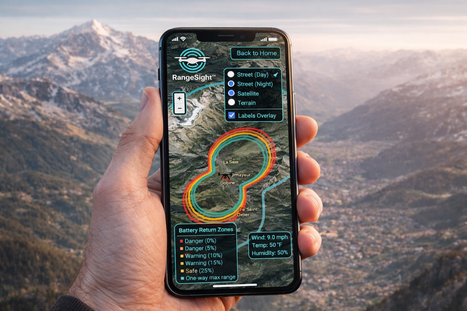
Now on Google Play & App Store | Free & PRO: Your range isn't a circle. Wind pushes you further downwind and holds you back upwind. RangeSight shows the real shape of your flight envelope with wind-deformed directional range rings calculated at 360 points.
On-Device Physics Engine
Every calculation runs on your phone. No internet required. No cloud processing. Your data never leaves your device. Results in under a second.
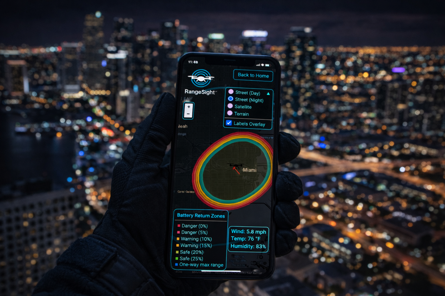
Wind-Aware Directional Range
Range rings deform based on wind direction and speed. See your actual flight envelope: further downwind, shorter upwind, calculated at 360 directional points.
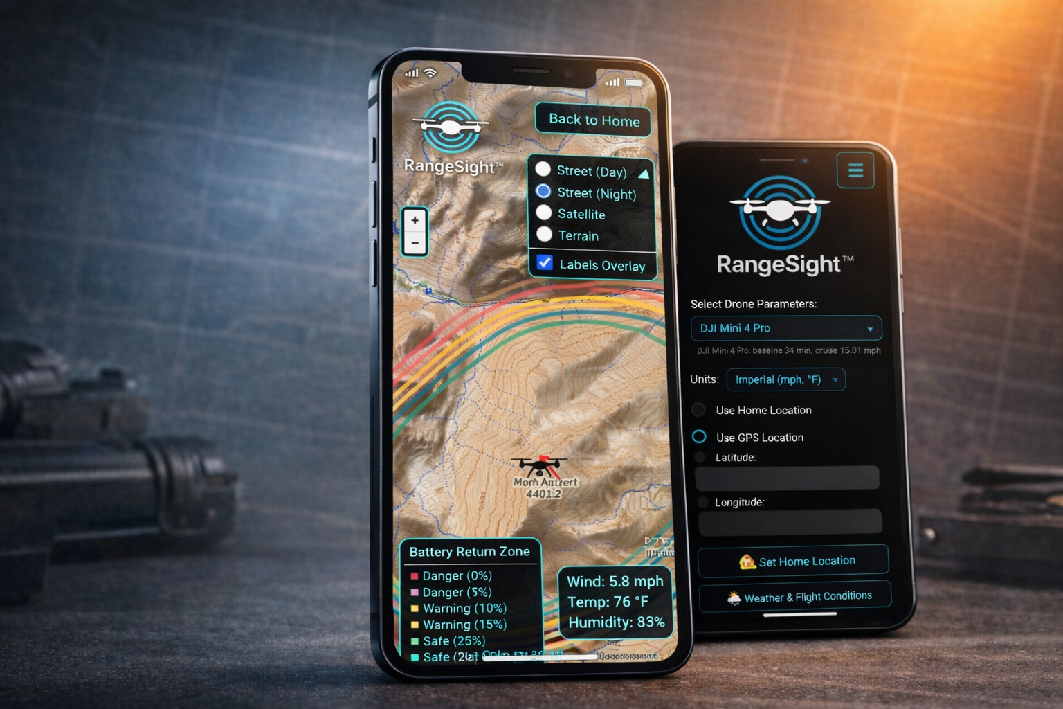
7-Ring Battery Safety System
Seven color-coded range rings show exactly how far you can fly and still return safely at different battery reserve levels, from 25% reserve down to one-way maximum.
Six Core Features
Everything you need for real-world flight planning, accessible from one interface.
Live Weather Data
PROOne-tap real-time weather from your GPS location. Wind speed, gusts, direction, temperature, and humidity, all color-coded against your drone's safety limits (green/yellow/red).
Flight Range Calculator
The RangeIQ™ engine combines wind, temperature, humidity, altitude, battery health, payload, and gust penalties into a single accurate prediction. Configurable battery %, cycles, cruise speed, hover time, and fine-tune calibration.
Interactive Map
4 map styles (Street Day/Night, Satellite, Terrain). Wind-deformed range rings, draggable map pins, animated wind direction arrow, weather overlay, and collapsible legend. Offline maps for North America and Europe are included. Custom Area Download (select any area for high-resolution tiles) coming soon.
31 Drone Profiles
The most comprehensive library available. 5 manufacturers: DJI (23), Autel Robotics (4), Parrot (2), Skydio (1), Freefly (1). From the 249g DJI Mini 4 Pro to the 11.5kg Freefly Alta X. Every profile tuned with manufacturer specs.
Offline Maps
PROOffline maps for North America and Europe are available now. No internet required in the field. Custom Area Download coming soon: select any area on the map and download high-resolution tiles directly to your device for sharper imagery and more coverage flexibility.
Payload & Safety
PROFull payload weight modeling with drone-specific efficiency curves. Battery cycle degradation tracking. Fine-tune calibration from real test flights. Color-coded weather safety thresholds per drone.
7-Ring Battery Safety System
Seven color-coded range rings show exactly how much battery you'll have for the return trip at any distance and direction.
31 Drone Profiles, 5 Manufacturers
The most comprehensive drone profile library available. Every profile tuned with manufacturer specs including battery capacity, weight, flight time, cruise speed, payload limits, and weather safety thresholds.
DJI (23 models)
Mini 4 Pro, Mini 3 Pro, Mini 3, Mini 2 SE, Mini 2, Mavic Mini, Air 3, Air 2S, Mavic Air 2, Mavic Air, Mavic 3 Pro, Mavic 3, Mavic 3 Classic, Mavic 2 Pro, Mavic 2 Zoom, Mavic Pro, Phantom 4 Pro V2.0, Inspire 3, Matrice 300 RTK, Matrice 30, Avata, Avata 2, FPV
Autel Robotics (4 models)
EVO Nano, EVO Nano+, EVO Lite+, EVO II Pro V3
Parrot (2 models)
ANAFI, ANAFI Ai
Skydio (1 model)
Skydio 2+
Freefly Systems (1 model)
Alta X (11.5kg, 16kg max payload)
Custom Drone Builder PRO
Build profiles for ANY drone: custom-built, modified, or niche aircraft. Simple and Advanced modes with 6 quick-start templates (Micro, Mini Camera, Standard Photography, Racing Quad, Cinematic, Heavy Lifter).
Free vs PRO
RangeSight is free to download with a powerful set of features. Upgrade to PRO to unlock live weather, payload modeling, advanced fine-tuning, the Custom Drone Builder, offline maps, and saved home location.
Free
$0
- All 31 drone profiles
- Full flight range calculator
- Interactive map with 4 styles
- 7-ring battery safety zones
- Wind-aware directional range
- Manual weather entry
- Draggable map pins
- Imperial & Metric units
PRO
RECOMMENDEDor $39.99/year (save ~33%)
Everything in Free, plus:
- Set Home Location: persistent saved home coordinates
- Live Weather: one-tap real-time weather from GPS
- Payload Modeling: drone-specific efficiency curves
- Advanced Fine-Tuning: calibrate from real flight data
- Custom Drone Builder: unlimited custom profiles
- Offline Maps: North America & Europe available now; Custom Area Download (high-resolution tiles) coming soon
Available via Google Play and App Store. Cancel anytime.
Privacy by Design
Use without creating any account
Flight data stays on your device
Zero analytics or telemetry
All calculations run locally
Powered by RangeIQ™: The Physics Engine for Drone Flight
RangeSight's outputs aren't hand-wavy estimates. They're produced by RangeIQ™, the proprietary on-device physics engine that processes wind, temperature, humidity, altitude, battery health, payload weight, and dozens of other variables through a multi-factor model.
RangeIQ runs entirely on your phone with no cloud dependency. Valthor is also extending RangeIQ into an API/SDK for enterprise integrations and iOS platform parity.
Learn about RangeIQ →Android 8.0+ (API 26) and iOS required. RangeSight is available on both platforms, powered by RangeIQ™ for consistent results.
Use Cases
RangeSight supports mission planning across a wide range of commercial and professional applications.

Infrastructure Inspection
Plan tower, pipeline, and utility inspections with confidence. Know your operational envelope before you arrive on site.

Real Estate & Video
Aerial photography and videography planning. Assess conditions and feasibility for client shoots in advance.

Construction Sites
Progress monitoring and site surveys. Plan missions around active construction constraints and site conditions.
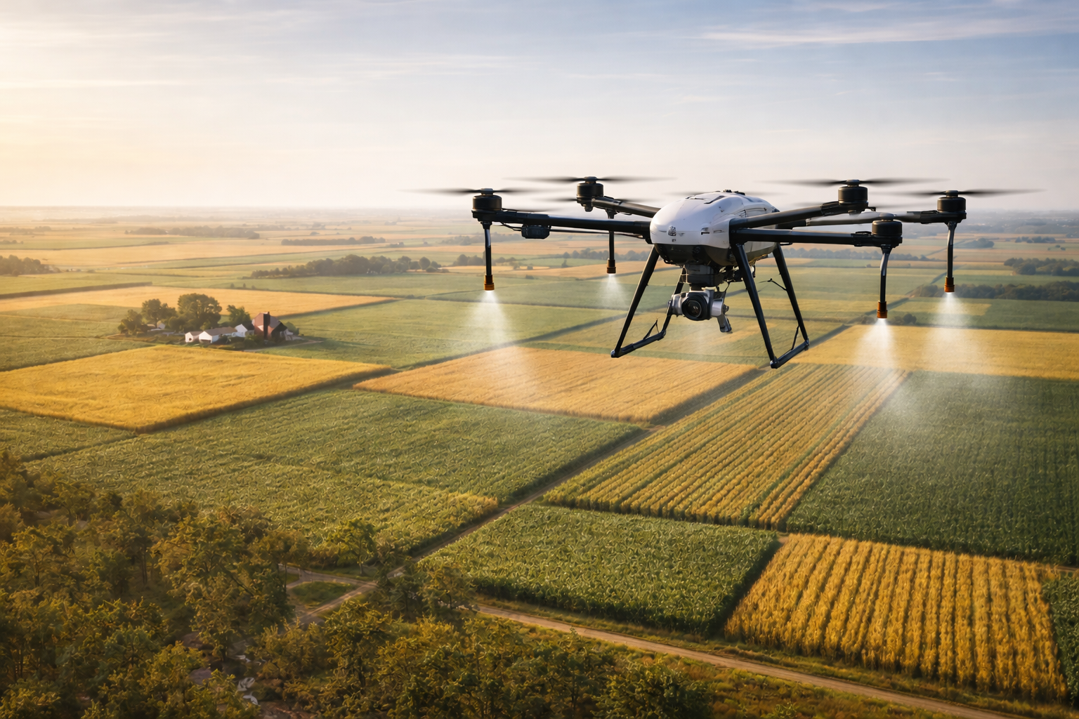
Agriculture & Mapping
Crop monitoring and field mapping in rural areas where connectivity is limited or unavailable.
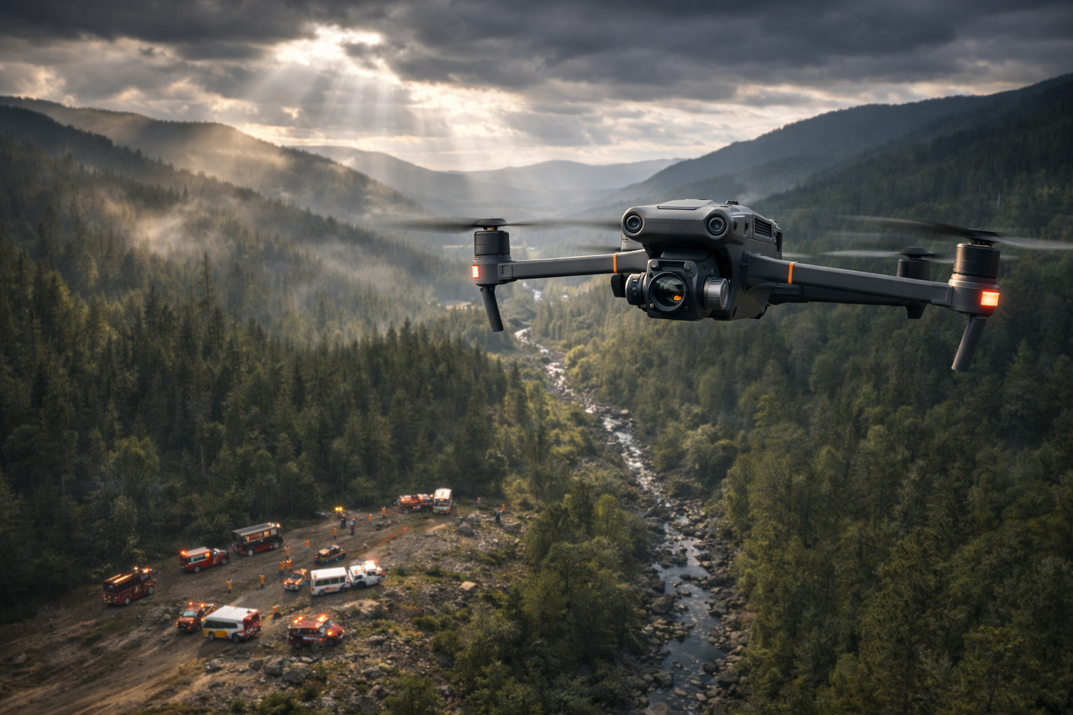
Public Safety Support
Search and rescue, emergency response planning. Rapid assessment of flight conditions in dynamic situations.
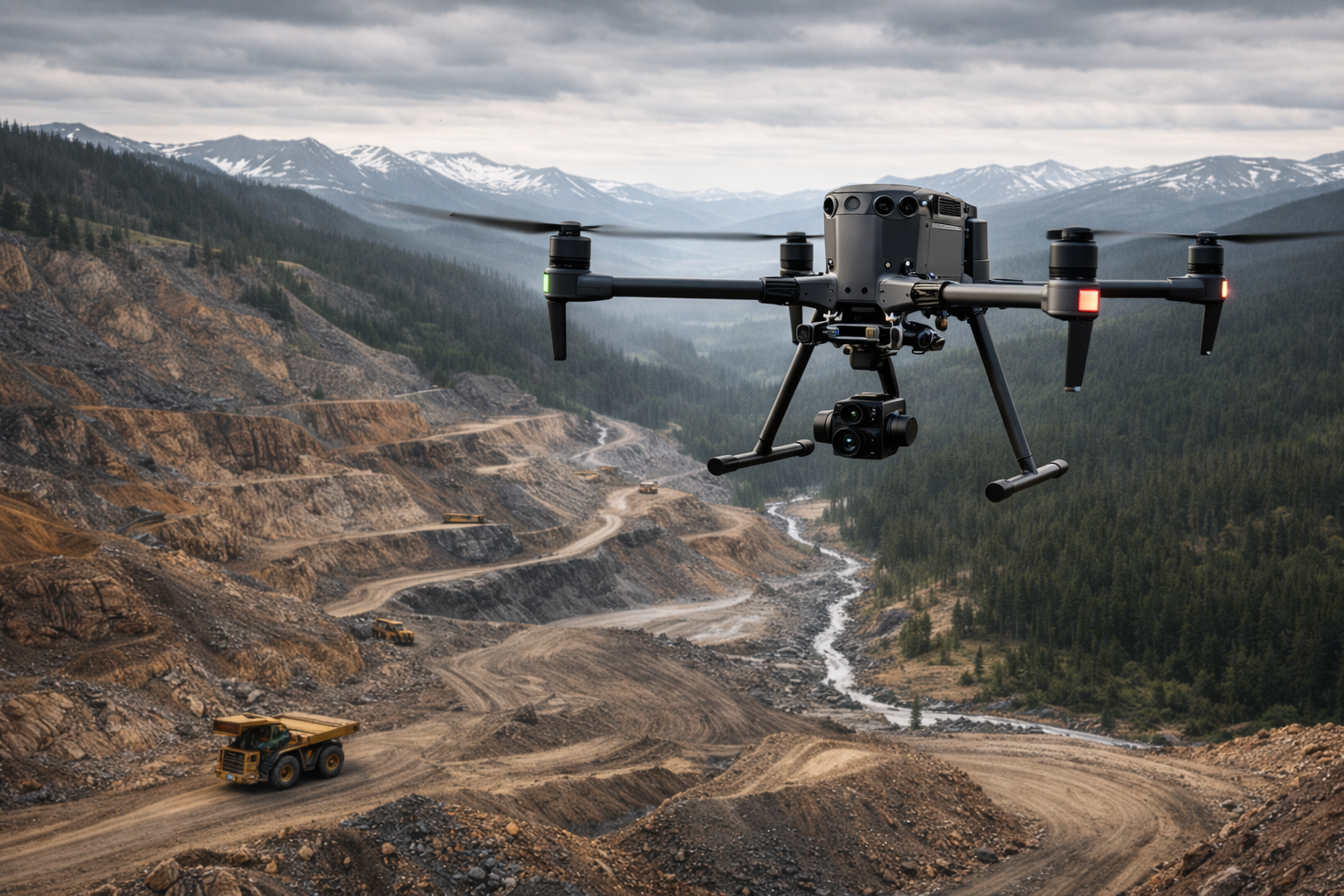
Remote Operations
Mining, forestry, and other remote site operations where reliable offline planning is essential.
Ready to plan with confidence?
Download RangeSight and start planning missions that work, even when connectivity doesn't.